We all love those fresh powder days! And usually the more fresh snow the better. But have you ever wondered what causes these major “dumps”?
In this article we will explain some basic weather principles that cause major dumps. We’ll look at the Alps in Europe as an example of how certain weather patterns end up in a bluebird pow day.
We will explain how the 3 main snow regions in the Alps are formed.
ALSO READ: “The Best Ski Resorts in Europe”
The main alpine ridge
The Alps can be divided into different countries such as Austria, Switzerland, France, Italy and Liechtenstein. However, countries don’t regulate the weather.
The major factor that influences the weather in the Alps is the main alpine ridge.
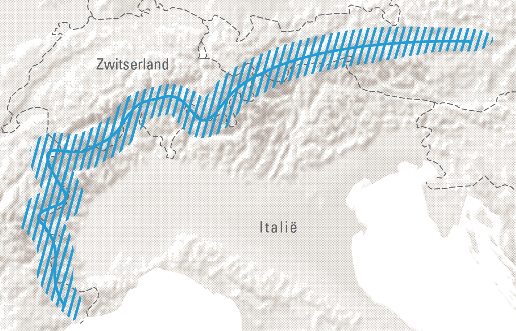
This is a line of the highest mountains in the Alps, which starts from the Mediterranean Sea all the way into Austria.
It is the natural barrier between Italy and Northern Europe.
The most important alpine peaks lie within the main alpine ridge.
Viewed from above, the main alpine ridge is not a straight line. Instead it’s a curve.
Therefore, the main alpine ridge influences precipitation from all 4 directions: north, east, west and south.
Stau and Föhn
Stau
When clouds with warmer and moist air from the oceans flow towards the mountains as a depression, the air is forced to rise. The depression is literaly pushed upwards against the mountains.
This causes the air to expand and cool down. Cold air can retain less moisture which causes condensation. Due to gravity, precipitation in the form of rain or snow will fall down.
The stronger the upward push, the more intense the precipitation will be at that time.
If the clouds stick around for long enough to create a huge dump we speak of: Stau
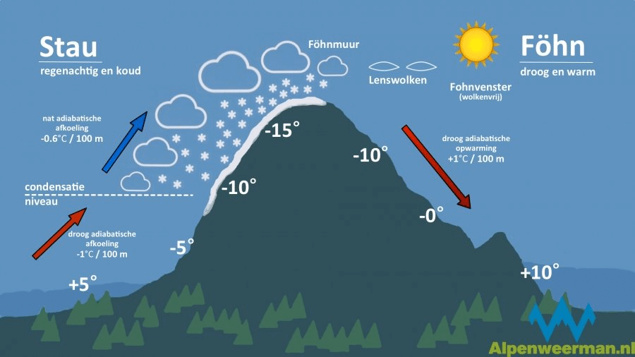
Föhn
In the meantime, at the other side of the mountain the air will descend. This will cause the air to warm up again.
The air temperature rises approximately 1 degree Celsius per 100 vertical meters.
Since most moist has fell down on the windward side of the mountain, the air is much dryer at the lee side of the mountain.
We call the dry warmer wind at the lee side of the mountain: Föhn.
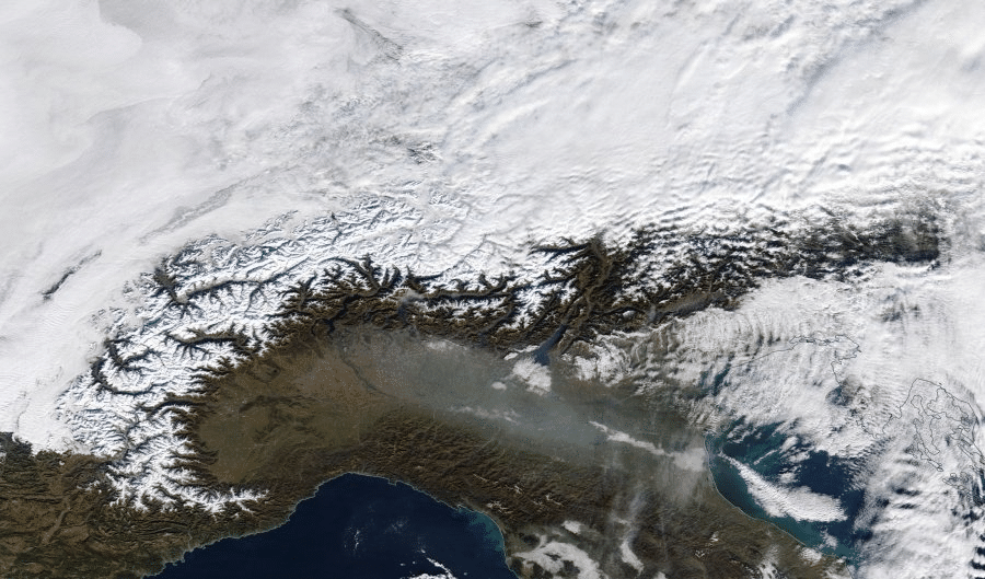
3 main snow regions of the Alps
Air flow around the Alps is strongly determined by the position of the jet stream, which comes from the west to Europe.
The main alpine ridge and the jet stream determine whether it will snow or not on a certain location in the Alps.
The main alpine ridge divides the Alps in 3 regions: North region, West region and South region.
North region & Nordstau
When a depression carrying clouds with moist and warm air comes from the north, it gets pushed against the north side of the main alpine ridge. When this happens for a longer period of time and very rapidly we speak of Nordstau.
In winter this will lead to massive snowfall at the north side of the main alpine ridge. Ski resorts in countries like Austria, Switzerland and Germany will benefit mostly.
At the South for instance, they will not benefit from the Nordstau in terms of snow.
West region & Weststau
Since the main alpine ridge forms a curve through the Alps, it has a Western facing part as well.
When a depression comes from the Atlantic Ocean (West), the air will get pushed on the Western facing part of the alpine ridge.
This results in Weststau or snow for France.
South region & Sudstau
The applies to warm and moist air that flows from the South.
The Italian ski resorts will benefit during sudstau.
Climate change
A recent study over 6 Alpine countries from 1971 – 2019 has shown that the observed snow depths are decreasing.
This means less snow is falling and more snow melts during the season. The latter is caused by warmer temperatures.
Some experts say that the Alps will get lesser and lesser snow. This could be caused by the changes considering the way the jet streams flow.