Perhaps the Matterhorn is not unknown to you. That iconic mountain in Switzerland of almost 4500 meters high. But do you already know the Rocher du Bieley or also called the “Matterhorn of Belgium”?
Of course, there is no 4500 meter peak, just a 2-hour drive from Brussels. But a spot known as the “Matterhorn of Belgium” arouses enough interest to jump in the car on a Sunday and drive off to Büllingen.
If you want to sleep in the region of the Rocher du Bieley you can do so in Büllingen (Belgium) or in Monschau (Germany).
Geographical location of Rocher du Bieley
The Rock of Bieley is located in Belgium near the border with Germany, in a spur of the Eifel nature park.
The rock is said to be the highest in Belgium and that’s why they call it “Matternhorn of Belgium”. Perhaps the pointed shapes of the rock have something to do with it as well.
It’s a half hour drive from Bütgenbach and Büllingen in the “Eastern Cantons”.
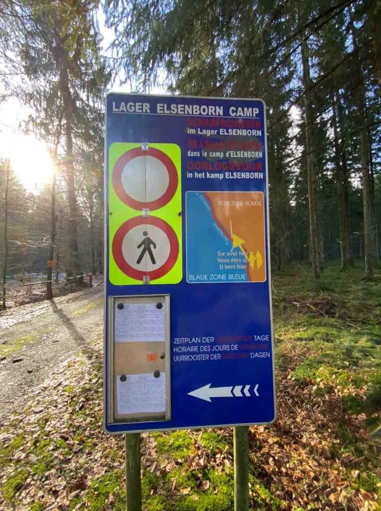
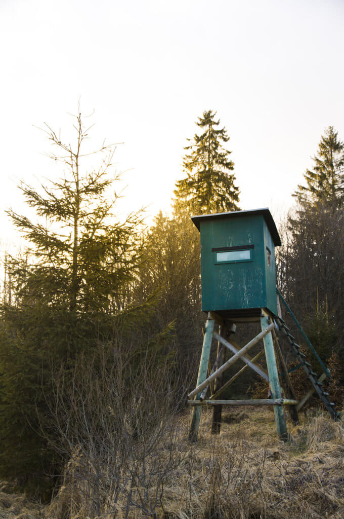
But what’s really remarkable is that he is not so easy to reach. This is not because of challenging terrain but because it is surrounded by military territory (Elsenborn).
Limited accessibility via Belgium
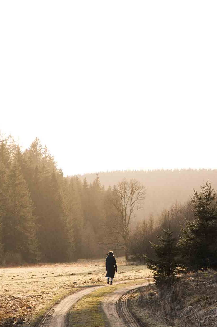
The most beautiful places are sometimes not so easy to find. That is also the case for the rocher du Bieley. After some research and a GPX in our pocket, we went out. However, we quickly came to the conclusion that the information we found online was not always clear.
From the village of Rocherath we follow the N658 towards Germany. According to the info we found online, the trail should start somewhere along this road.
However, we noticed that the GPX (GPX what?) we found online did indeed start from Belgium. At the start, it soon became clear that this was not an option. A large no-entry sign with a printed calendar below. And yes, for our date: “shooting drills – risk of mortal danger”. We don’t think it’s such a good idea to walk into this zone 😉 .
Restricted area military domain Elsenborn.
However, I do think that on some days it is perfectly possible to walk through Belgium to the rock. Perhaps this walk is even more beautiful than the German one. But keep in mind that the area is often closed for military target practice. You can check this in advance here.
So back in the car and trying to look for another access. In the back of our minds, we still remember that access from Germany was possible. We continue on the N658 and enter Germany. Just after the border crossing we turn left and we see a parking lot: Parkplatz Wahlerscheid
From here we start our search for the Rocher du Bieley!
TIP: It is best to immediately enter this parking in Google Maps.
The walk to Rocher du Bieley
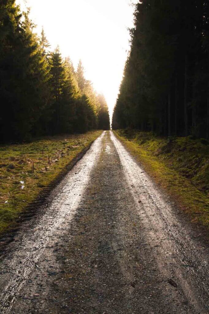
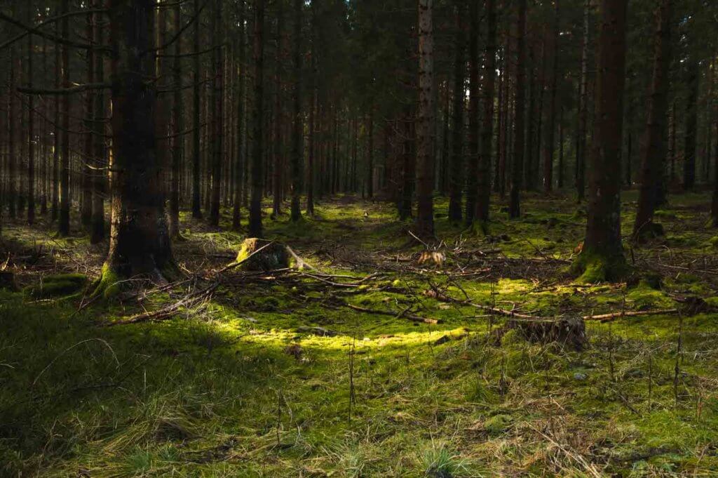
At Parkplatz Wahlerscheid, a forest path runs perpendicular to the street. This is the start of the route from Germany to the Rocher du Bieley.
Anyone who thought that the rock would be clearly marked from the beginning is wrong! The rock is not indicated anywhere on the official signs along the route. So it is best to take your GPS with you.
From Germany you have 2 options:
You start from Germany and after about 3 kilometers you come to a crossing where you have the opportunity to continue walking in the military domain (Belgium) (depending on accessibility). This route is approximately 5 kilometers long.
You follow the almost completely German route, in case access to the military domain (Belgium) is prohibited. In that case, the route is a lot longer and 9.5 kilometers long. Google Maps will take you to the Bieley-Felsen point. From there you still have to find a few hundred meters over Belgian territory and try to find the rock itself (according to Google Maps there is no road to it).
In our case, we were forced to follow the “entirely” German route. At the end we had to find the rock on our own.
The target practice in the military area lasted until 17:00 that day. This way we were able to return via the shorter route. Be prepared with a flashlight or Petzl if you leave in the afternoon, especially in winter!
Perlenbachtal Nature Reserve
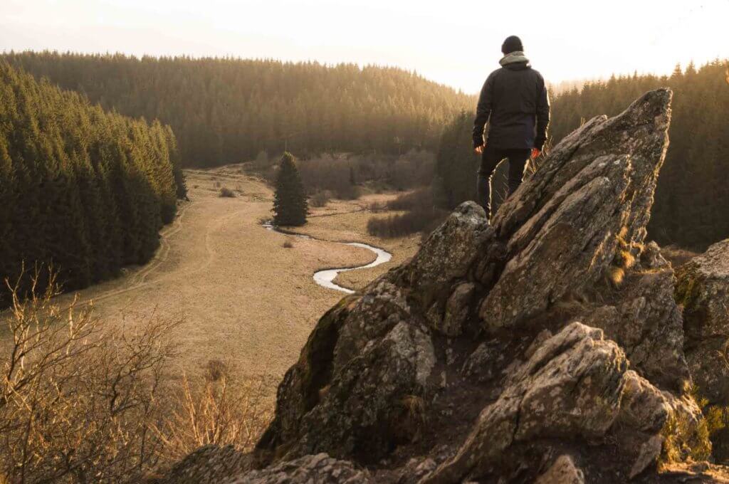
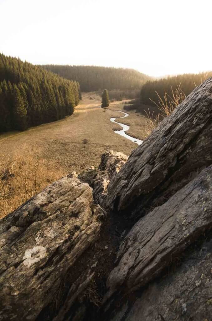
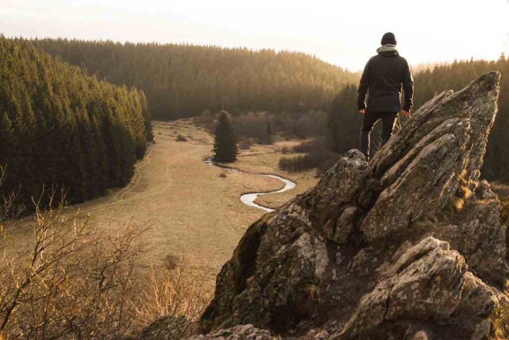
Finally we found the location of the Rocher du Bieley. It is off the hiking trail and hidden behind some trees.
It must be said… the comparison with the Matterhorn is very optimistic. Or maybe this rock just has some megalomania. BUT… what a beautiful hidden nature spot in the vast forests of the Belgian East Cantons!!
The jagged rock peaks are truly a unique sight. Something you don’t immediately expect to see in Belgium. Add to that a fantastically beautiful view and you can speak of a real hidden gem.
From the Rocher du Bieley you look out over the Perlenbachtal nature reserve. It is a valley enclosed by woods through which a small river, the Perlenbach, meanders.
A panoramic view, the sound of a babbling brook and nothing else… It is absolutely worth visiting this place!
TIP: leave on time so that you can certainly also walk down in the valley.
Would you rather admire the real Matterhorn? Discover these and other international hiking routes on our site, download the GPX files and go on an adventure yourself!
Hi, I’m Manou, founder of GPXadventures.com which grew from my passion for outdoor sports and adventure travel. Growing up, I developed a deep love for hiking, skiing, mountain biking, and exploring the great outdoors. I started this website as a way to share my knowledge, insights, and tips with like-minded individuals. My goal is to help others discover the joys of the outdoors and to encourage them to pursue their own adventures in nature.
#Livetheunknown
Hi, I’m Manou, founder of GPXadventures.com. My goal is to help others discover the joys of the outdoors and to encourage them to pursue their own adventures. #Livetheunknown
We use cookies to optimize our website and our service.
Functional
Always active
The technical storage or access is strictly necessary for the legitimate purpose of enabling the use of a specific service explicitly requested by the subscriber or user, or for the sole purpose of carrying out the transmission of a communication over an electronic communications network.
Preferences
The technical storage or access is necessary for the legitimate purpose of storing preferences that are not requested by the subscriber or user.
Statistics
The technical storage or access that is used exclusively for statistical purposes.The technical storage or access that is used exclusively for anonymous statistical purposes. Without a subpoena, voluntary compliance on the part of your Internet Service Provider, or additional records from a third party, information stored or retrieved for this purpose alone cannot usually be used to identify you.
Marketing
The technical storage or access is required to create user profiles to send advertising, or to track the user on a website or across several websites for similar marketing purposes.